


Rando col du Drouillet

rigol05
User
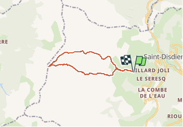

Length
11.9 km

Max alt
2258 m

Uphill gradient
865 m
Km-Effort
23 km

Min alt
1423 m

Downhill gradient
856 m
Boucle
Yes
Creation date :
2018-06-26 16:54:23.027
Updated on :
2018-06-26 16:54:23.027
4h39
Difficulty : Difficult

FREE GPS app for hiking
 SityTrail
IGN / Geographical institutes
SityTrail Plus
The world is yours!
About
Trail Walking of 11.9 km to be discovered at Provence-Alpes-Côte d'Azur, Hautes-Alpes, Le Dévoluy. This trail is proposed by rigol05.
Positioning
Country:
France
Region :
Provence-Alpes-Côte d'Azur
Department/Province :
Hautes-Alpes
Municipality :
Le Dévoluy
Location:
Saint-Disdier
Start:(Dec)
Start:(UTM)
727693 ; 4956670 (31T) N.
Comments